
Copenhagen-based artist Jeppe Knudsen Ringsted merges science, design and cartography in Mappa Animalia, a visual project that reimagines the evolutionary relationships of animals as detailed map-like landscapes.
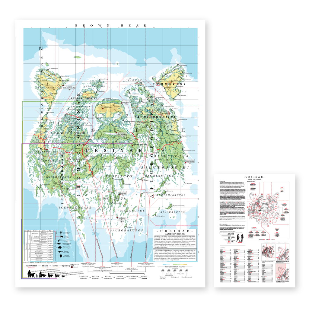
Instead of political borders or geographical territories, Ringsted’s maps are structured around phylogenetic trees, translating the scientific classification of species into navigable visual worlds. Subfamilies, tribes and genera become regions within these imagined territories, allowing viewers to explore the animal kingdom through a format traditionally used to understand geography.
“My inspiration comes from nature and a love for maps,” Ringsted explains. “A map can be beautiful to look at, while also containing huge amounts of information you can spend hours exploring. I wanted to recreate that experience, but with the evolutionary family trees of animals instead.”
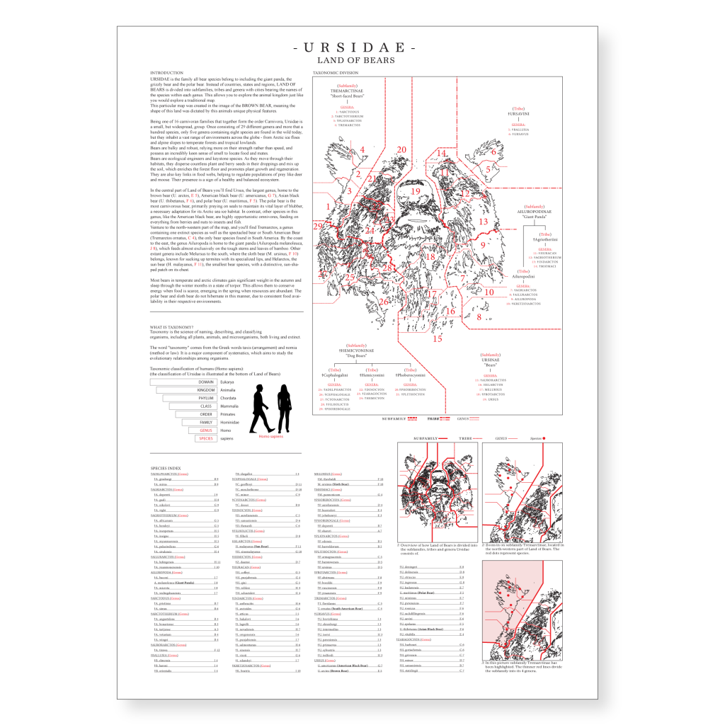

Each Mappa Animalia illustration follows scientifically accurate phylogenetic structures. By studying the branching relationships between species, Ringsted constructs intricate landscapes where each visual division corresponds to a real biological classification. The resulting works allow viewers to identify where individual species sit within broader taxonomic systems, while also indicating their conservation status—whether vulnerable, threatened or listed as of least concern.
The maps function both as artworks and as educational tools. To make the information more accessible, each piece is accompanied by a detailed data sheet or supplementary illustration that expands on the scientific structure behind the composition. These include species indexes, taxonomic breakdowns and additional contextual information about the animals represented in each map.
Through this blend of illustration and scientific research, Mappa Animalia aims to encourage viewers to think more deeply about humanity’s relationship with the natural world.

“The animal kingdom is just as important to nature as nature is to us,” says Ringsted.
Among the works in the series are pieces such as Ursidae – Land of Bears and Elephantidae – Land of Elephants, presented as large-format art prints available in sizes including 30 × 40 cm, 50 × 70 cm and 70 × 100 cm.
Ringsted, who is self-taught, has spent more than a decade intermittently developing the Mappa Animalia project before refining it into its current form over the past year. Alongside this work, he is internationally recognised for his distinctive “puddle prints”, artworks created by painting directly into rain puddles around cities worldwide.
ARTIST LINKS
Website